Flooding and drainage
Some concerns were mentioned during our phase 1 consultation relating to flooding. The vast majority of the site is located within Flood Zone 1 and as such is considered to be at lowest risk of flooding. There is a flood zone at the eastern boundary of the site associated with the River Penk. However, that is significantly lower than the remainder of the site and there will be no development in this area. We are proposing to create a publicly accessible riverside community parkland in that flood zone area to maximise its potential.
A Flood Risk Assessment of the site will form part of the planning application. This will include a review of the available hydraulic modelling information for the River Penk and the watercourse that crosses through the application site. The Flood Risk Assessment will include recommendations for any mitigation measures required to ensure that the proposed development is safe from all flood risk sources for the proposed development’s lifespan and the assessment will consider the future impacts of climate change on flood risk. The measures proposed within the Flood Risk Assessment will ensure that flood risk does not increase within the local area as a result of the development.
Surface water from the Site will be managed through the implementation of a surface water drainage strategy, designed in accordance with the latest local and national guidance for the design of Sustainable Drainage Systems (SuDS).
Foul water flows from the development will be drained via gravity to an existing Severn Trent Water foul water public pumping station, before being directed towards the existing Wastewater Treatment Works at the northeast application boundary.
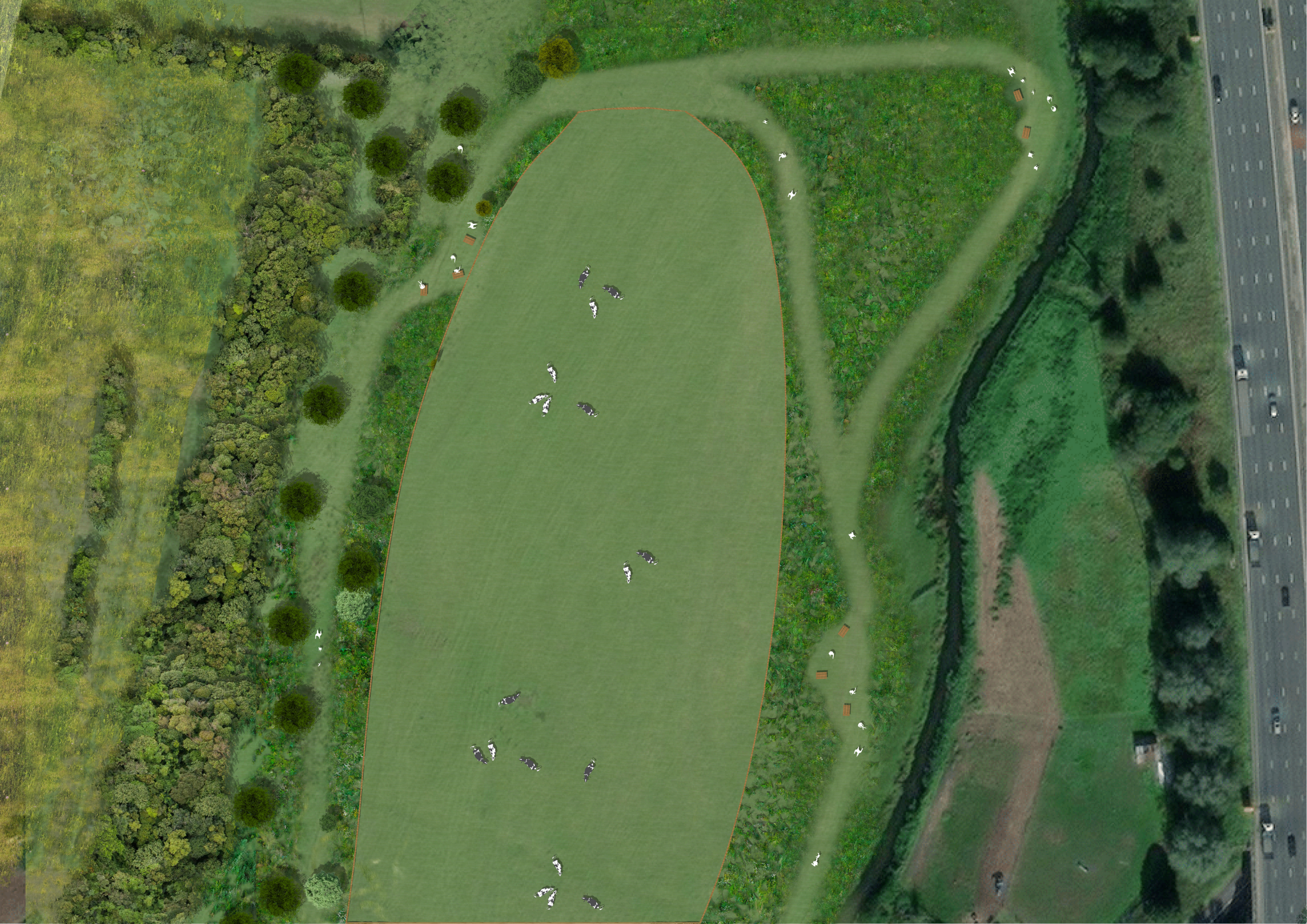
The existing flood plain associated with the River Penk will be the location for a community riverside park - Click image to enlarge
Utilities
A utilities assessment is currently being prepared to assess the proposed development’s likely effects on the utilities network within and in proximity to the Site, including things such as existing gas mains, electricity supply lines, existing water supply and foul water drainage.
Landscape and visual matters
A full Landscape and Visual Impact Assessment (LVIA) will be submitted alongside the forthcoming planning applications. The LVIA will establish the existing baseline, and ascertain the landscape and visual impact of the proposed development by assessing the proposals as set out in the final Masterplan. It will identify the additional mitigation that is required to minimise or avoid impacts.
The site has a relatively constrained visual envelope due to the local level relief and lack of pronounced topography features. Clear open views of the site are available only within the site itself and from locations close to the site to the west, east and north. Indeed, it is only from rising ground further to the east (beyond 1km) where views of the site begin to become available, as land rises in vicinity of Cannock Chase. However, there is a lack of potential public receptor locations in that area, and woodland around Cannock Chase restricts the ability to view the wider landscape in any case.
The detailed understanding of the landscape and visual setting of the site and the surrounding areas has informed the emerging Masterplan. It has guided the carefully considered approach that the Masterplan takes in terms of the location and form of the proposed built development, green infrastructure corridors, and strategic planting. The Masterplan proposes to supplement the existing landscape framework by delivering strategic woodland planting at the west, north and eastern parts of the site. That will soften views of the built development and provide a transition between the edges of the site and the surrounding landscape.
Air quality
An air quality assessment is being undertaken to determine the potential for impacts during both the construction phase and operational phase of the proposed development. This will include a screening assessment of road traffic emissions associated with construction phase traffic, as well as a detailed assessment of road traffic emissions associated with additional trip generation as a result of the proposed development. Mitigation measures commensurate to the construction phase impacts and mitigation measures for the operational phase of the proposed development will be recommended, if required.
Noise
A noise and vibration assessment is currently being prepared which considers the potential for adverse noise and vibration impacts at nearby existing residential properties during the construction phase, and once the proposed development has been completed. Furthermore, the assessment considers the potential for adverse impacts at the proposed residential properties within the development.
With respect to potential noise impacts affecting the proposed residential properties within the development site, the dominant sources of noise identified during the baseline survey are:
- Road traffic on the M6;
- Road traffic on Stafford Road;
- The railway lines to the west; and,
- Operational noise from the ADP premises.
Due to the proximity of the Site to these sources of noise, consideration will be given to appropriate mitigation measures that could be incorporated into the development.
Heritage
A Heritage Statement is currently being undertaken which will examine any potential impact of the proposed new neighbourhood on built heritage and archaeology during construction and once completed. The assessment will provide recommendations for suitable mitigation measures to minimise any negative impact on heritage assets and the archaeological resource.
Initial assessment has suggested that the development is unlikely to have any impact on the setting or significance of the Penkridge or Staffordshire and Worcester Canal Conservation Areas and their associated Listed Buildings or Locally listed Buildings. To the north, the Grade II Listed Lower Drayton Cottages and the Grade II Listed Lower Drayton Bridge and associated non-designated heritage asset associated farm structures are to be assessed. However, there is no intervisibility between those buildings and the Site. The Old Drayton Farm House to the east of Stafford Road has some local heritage interest and is to be assessed as part of the Heritage Statement.